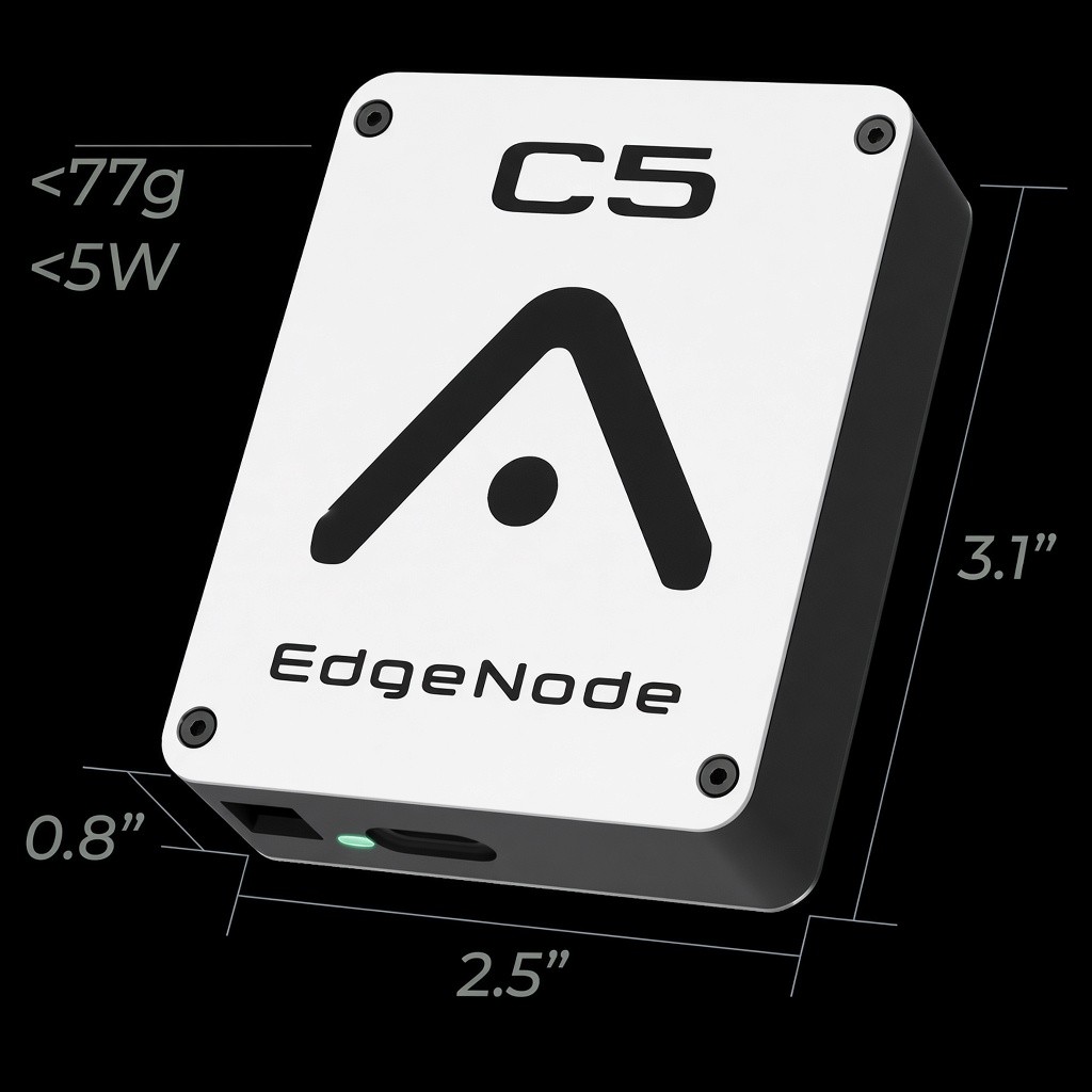
C5 EdgeNode
800 MHz + C‑V2X mesh on every aircraft. A2X 5030 when adopted.
3.1″ × 2.5″ × 0.8″ · <77g · <5W
Vision: zero collisions in the air
Every drone, eVTOL, light aircraft, and eventually large commercial aircraft — civil and defense — connected for electronic conspicuity. Free COP and API at airspacex.com, powered by AeroNet UTM. C5 EdgeNode meshes air-to-air; Starlink keeps the picture alive when towers drop.
Drones, eVTOL, helicopters, light aircraft, and large commercial aircraft intersecting below 2,000 ft — each carrying C5 EdgeNode, mesh-linked air-to-air, with Starlink satellites carrying the picture back when the ground network can’t.
800 MHz + C‑V2X mesh on every aircraft. A2X 5030 when adopted.
3.1″ × 2.5″ × 0.8″ · <77g · <5W
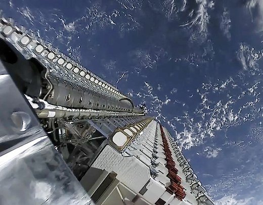
When terrestrial links drop, Starlink keeps AeroNet fed beyond line of sight.
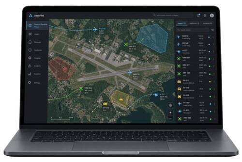
The AirspaceX COP for low-altitude airspace, powered by AeroNet UTM — or bring your own through the API. aeronetutm.com
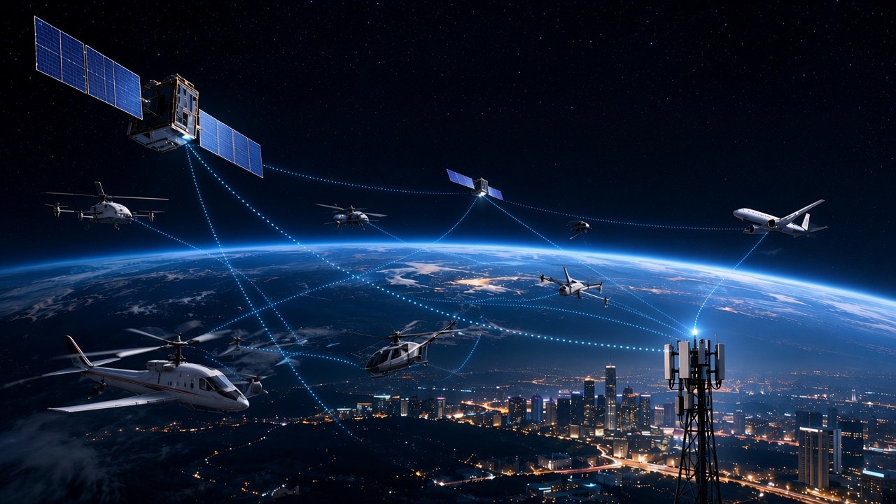
C5 EdgeNode on every aircraft, Starlink backhaul when towers drop, and a COP powered by AeroNet UTM — or bring ATAK / WinTAK / SitaWare / your stack via API.
Real-time location of every edge node — crewed, uncrewed, and ground — in one live picture.
Connected systems detect conflicts and clear each other automatically in under 100 ms — no cloud round-trip required.
P2P, one-to-many, multi-hop secure messaging across the mesh.
Swarm and multi-domain ops: form, divide, adjust, and regroup in real time.
Hand C2 to the operator who needs it — one-to-many control across mixed fleets.
Scales past 1,000 nodes. Survives node loss and reroutes automatically.
Electronic conspicuity tags every node by type. Emergency response and piloted aircraft get right-of-way — automated and uncrewed traffic yields first.
Dynamic restricted volumes — TFRs, incident scenes, restricted airspace — pushed to the mesh so every node deconflicts against them, not just against other aircraft.
Routes, landing zones, and mission areas for connected operations — without re-entering restricted volumes by hand.
COP powered by AeroNet UTM — or bring ATAK, WinTAK, SitaWare, or your own interface.
Low-altitude airspace is filling up faster than anyone can see it. The first confirmed drone–aircraft collision in U.S. history was an Army Black Hawk and a consumer-grade drone. The vision is simple: zero collisions in the air — every aircraft connected for electronic conspicuity so they can clear each other in real time.
Drones, eVTOL, light aircraft, and eventually large commercial aircraft carry C5 EdgeNode — civil and defense — so shared airspace has a shared picture.
As airspace grows more automated, conspicuity lets medevac, firefighting, law-enforcement, and piloted aircraft claim priority — drones and autonomous eVTOL clear the way.
TFRs, incident scenes, and restricted volumes push to the mesh as tactical geofences, so every node deconflicts against the map — not only against other aircraft.
airspacex.com is the free common operating picture and API for everything that moves — and the store path for C5 EdgeNode.
Onboard module for every drone, eVTOL, and light aircraft. 800 MHz + C‑V2X today, A2X 5030 when adopted — position and intent on the mesh so traffic stays electronically conspicuous even when towers drop.
Free access to the AirspaceX COP and API — visualize everything that moves. Powered by AeroNet UTM; any COP plugs in through the API. OEMs, operators, cities, airports, and investors welcome. Starting in Detroit.